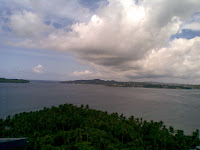
 Our resort (the Fortune Bay Island resort) had a fantastic view of the bay and North Island.
 Port Blair does have basic infrastructure (unlike Havelock, but more on that later) - you do get a cellphone signal sometimes, and typically get yesterday's newspaper.
Post Blair was only our base station. From there, we visited a multitude of different islands. Viper island was the first - it was somewhat macabre, since all it contained were a prison house and a gallows, and especially since it had been devastated completely by the tsunami and had been abandoned since!!
The next island we went to was North Bay. The island is known for its beach where one can snorkel. We took a glass bottomed boat and saw some corals (which were mostly dead, alas!). However, we took off into the forest and were rewarded for our efforts when we came to this massive lighthouse (the same as seen behind the twenty rupee note!). After a rough and tough climb to the top of the lighthouse, we were rewarded with a massively cold and strong breeze, and a view to die for!! Check out the misty mountains in the distance.
 |  |

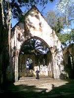
Our next stop was at Ross Island. This island is only a small distance away from Port Blair, and was the erstwhile colony of the British army. It was known as the Paris of the East, so beautiful was it. Even now, ruins of the Brit settlement can be seen. The island is currently owned and run by the Indian navy, and has deer and peacocks, in addition to a beautiful melancholy abandoned beach and lonely World War II Japanese bunkers!!
 |  |
Next came Baratang Island. To reach this distant place, we had to pass through a tribal reserved forest (no pictures are permitted, so we dont have any, though we did manage to see a lot of tribals). The tribals are totally naked, except colorful belts of beads, and are seen with bows and arrows. They looked totally African, with flat noses, very dark complexions and curly hair!
Baratang island is in the middle of a mangrove swamp. The boat ride to the limestone caves was awesome, through dense and thick mangroves!!
 |  |
 |  |
We encountered some wild fauna en route (check out this sleeping bat from close quarters and this multicolored reptile!!)
 |  |
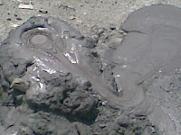
After returning from the mangroves, we trudged further uphill on Baratang to view this mud volcano. Though we could see the bubbling mud oozing out, I must confess the damn thing was a bit underwhelming. Somehow when I think volcano I think of huge craters and large seething masses of lava. This was unique, but distinctly timid :-)
More to go in part III...

 Second trivia question - what place is this??
 We travelled a lot by a small boat between these islands, and though the waters are usually friendly and emerald green, they do suddenly become very scary, black and opaque whenever its cloudy!! More recently, the islands were severely affected by a tsunami, and even a eighteen months later, the effects are there to see - uprooted massive trees, waterlogged shops and destroyed flora, ships etc.


 This graph shows (on the columns) the number of posts per month, and (on the line) the average days per post for each month. Clearly, Alam is correct when he says that postings in March are frequent - as can be seen on the RHS y axis, the average post has been occuring every 3.2 days since the inception of this blog, and the March numbers are pretty close to the average. Clearly, September was an aberration, since I posted a flurry of articles in the first romantic blush of blogging. Oct - Dec were normal months, but Jan and Feb really brought down the average (perhaps because I was mentally disturbed? who knows? - interestingly this means that I'm in good mental health in March!!)